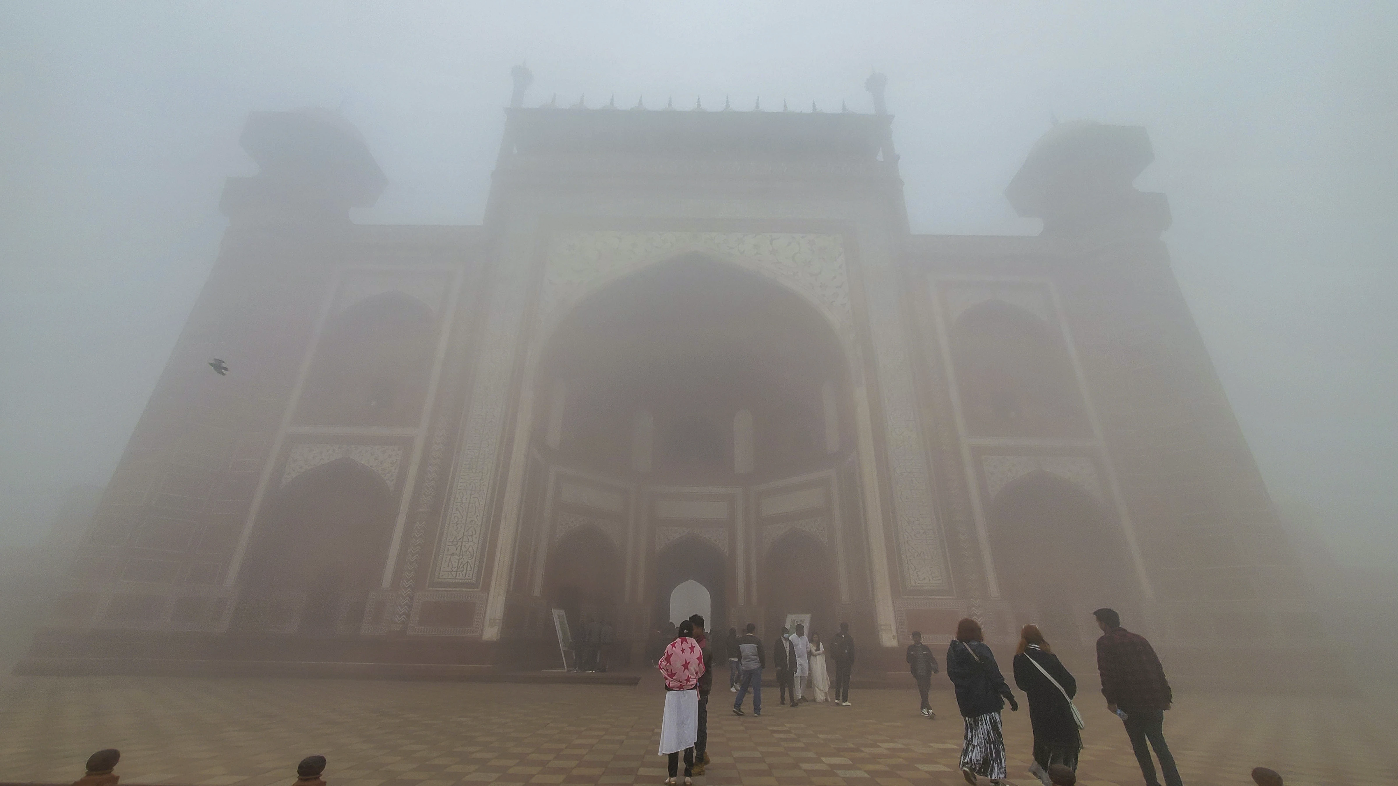
New Delhi, Jan 19 (PTI) A layer of fog, stretching from Punjab to West Bengal, lowered visibility over the Indo-Gangetic plains starting Thursday night, affecting road and rail traffic, officials said on Friday.
Satellite imagery showed fog developing over parts of Punjab, Haryana, north Rajasthan, and west Uttar Pradesh starting at 8 pm on Thursday.
An official at the India Meteorological Department (IMD) said dense to very dense fog blanketed parts of Punjab, Rajasthan, Haryana, Delhi, and Tripura. Moderate fog prevailed in parts of Uttarakhand, east Uttar Pradesh, Bihar, Jharkhand, and Odisha.
At 5.30 am, visibility levels stood at zero metres in Bathinda and Bikaner; 25 metres in Amritsar and Patiala; 50 metres in Ganganagar, Churu, Hisar, Palam, Safdarjung, Jaipur, and Agartala; and 200 metres in Ambala, Dehradun, Sultanpur (east UP), Purnea, Bhagalpur, Ranchi, and Jharsuguda.
A spokesperson for the Indian Railways said 22 trains arriving in Delhi were delayed by up to six and a half hours due to the foggy weather.
The IMD reported that the visibility level plummeted to zero metres at the Amritsar airport by 8 pm, while it abruptly dropped from 1400 metres at 9.30 pm to 400 metres at 10 pm at the Palam Observatory, near the Indira Gandhi International Airport.
It further dropped to 50 metres by 11.30 pm and zero metres by 4.30 am, before improving to 300 metres by 7.30 am.
Early morning foggy weather in north and northeast India has heavily impacted road, rail, and air traffic since the end of December.
IMD scientists say the absence of active western disturbances — weather systems originating in the Mediterranean region and bringing unseasonal rainfall to northwest India — is the reason behind the blinding layer of fog persisting over the plains in northwest India since December 25.
Generally, five to seven western disturbances impact the region during December and January. But this winter has not seen any so far, they said.
Two western disturbances affected the country, one in December and another in January, but their impact remained confined to Gujarat, north Maharashtra, east Rajasthan, and Madhya Pradesh, they said.
IMD scientist Naresh Kumar told PTI, “Fog formation requires three conditions: weak low-level winds, moisture, and low temperature (overnight cooling). Active WDs, characterised by strong winds and precipitation, disrupt these conditions.”
According to a report authored by IMD scientists Kumar, Krishna Mishra, and R K Jenamani, the maximum temperatures have been below normal by 5-8 degrees Celsius over the northern plains since December 29, with a brief respite on January 7-8 due to a western disturbance.
The minimum temperatures have been below 4 degrees Celsius at many stations in the region from January 12 to 17.
This severe weather is due to mainly three reasons: lack of active western disturbances over northwest India, prevailing El-Nino conditions, and a strong jet stream, they said.
Strong jet streams, which are bands of strong wind that generally blow from west to east all across the globe and impact weather, have been prevailing over north India for the last five days.
It is leading to the subsidence of cold air and enhancing cold wave/cold day conditions over the region. These conditions are likely to continue over the next five days.
The lack of active WDs can also be attributed to the prevailing El-Nino conditions — abnormal warming of surface waters in the central Pacific Ocean.
During El-Nino years, there are fewer cold wave days over north India during December and January.
The IMD said “dense to very dense” fog conditions are likely to prevail over north India for the next five days.
According to the weather office, “very dense fog” is when visibility is between 0 and 50 metres, between 51 and 200 metres is “dense”, between 201 and 500 metres “moderate”, and between 501 and 1,000 metres “shallow”.
In the plains, the Met Office declares a “cold wave” if the minimum temperature dips to 4 degrees Celsius or when the minimum temperature is 10 degrees or below and is four-and-a-half notches below normal.
A “severe cold wave” is when the minimum temperature dips to 2 degrees Celsius or the departure from the normal is by more than 6.4 degrees.
A “cold day” is when the minimum temperature is less than or equal to 10 degrees Celsius below normal and the maximum temperature is at least 4.5 degrees below normal.
A “severe cold day” is when the maximum is 6.5 degrees Celsius or more below normal.

